Geology Resources
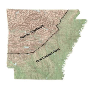
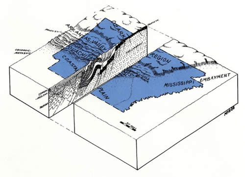
Arkansas is divided topographically into two major provinces along a northeast-southwest trending "fall line". This imaginary line divides resistant sedimentary Paleozoic rocks of the Interior Highlands from unconsolidated sediments of the Gulf Coastal Plain. Each province is further divided into five physiographic provinces of Arkansas.
Physiographic regions of Arkansas
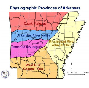
Map of the Physiographic Provinces of Arkansas
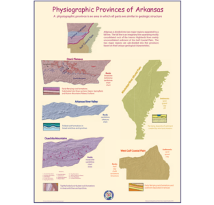
Physiographic Provinces of Arkansas Poster
Geologic History of Arkansas Through Time and Space
Physiographic regions of Arkansas
Map of the Physiographic Provinces of Arkansas
Physiographic Provinces of Arkansas Poster
Geologic History of Arkansas Through Time and Space
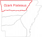
Ozark Plateaus Province
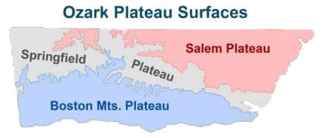
The Ozark Plateaus is a thoroughly dissected area with steep valley walls and narrow floors. This province is divided into three broad plateau surfaces based on elevation and age of surface rocks.
Geology of the Ozark Plateaus
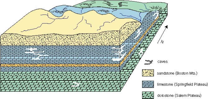
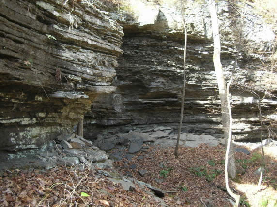
The geology of the Ozark Plateau is characterized by slightly southward-dipping sedimentary rock deposited mostly by shallow marine seas from the Ordovician through the Pennsylvanian Period. Caves and sinkholes are common in limestones of the Springfield Plateau with less karst development in the dolostones in the Salem Plateau. The Boston Mt. Plateau surface contains mostly sandstones and shales deposited by south/southwestward flowing streams during times of low sea level.
Salem Plateau
The Salem Plateau contains the oldest rock at the surface - Ordovician dolostones, sandstones and limestones. This is also the lowest plateau surface with some of the highest elevations reaching between 800 and 1400 feet above sea level.
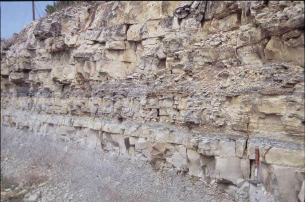
Dolostone with interbedded shale in the Powell Formation
Dolostone in the Cotter Formation at Cotter, AR
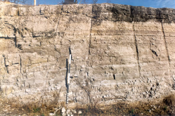
Springfield Plateau
The Springfield Plateau contains mostly Mississippian age limestone and chert from the Boone Formation at the surface. This plateau is intermediate in elevation with some of its highest elevations reaching 1800 feet above sea level. The plateau surface consists mostly of gently rolling hills or an undulating topography, however in some places the Boone Formation forms steep hillsides separated by ravine-like drainages.
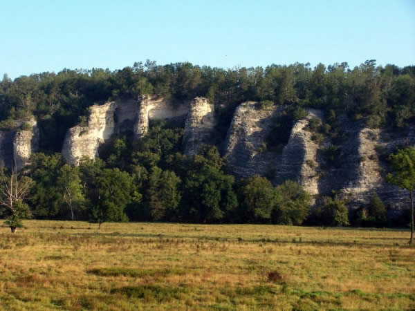
Boone Formation forming buttresses along Bear Creek in Searcy County.
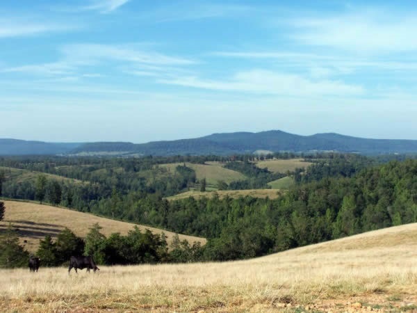
The Springfield Plateau (foreground) near Marshall, Arkansas.
Boston Mountains Plateau
The Boston Mts. Plateau contains the youngest rock at the surface - Early Pennsylvanian sandstones and shales with minor limestones. This is also the highest plateau surface with some of the highest elevations reaching 2200-2500 feet above sea level.
Bloyd Formation near Phillips Ford
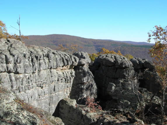
Middle Bloyd sandstone at Buzzards Roost.
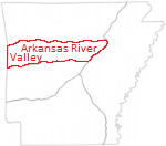
Arkansas River Valley Province
The Arkansas River Valley is a low-lying province surrounding the valley of the Arkansas River and its major tributaries. The highest point in Arkansas (Mount Magazine – 2753 ft.) is found among several mountain ridges that rise above the lowlands in the southern portion of the river valley. The mountain ridges are separated by broad valleys. Surface rocks in this province consist of a sequence of coal-bearing sandstones and shales.
Geology of the Arkansas River Valley
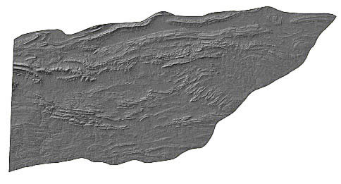
The Arkansas River Valley represents the northern extent of the Ouachita orogenic (mountain building) system in Arkansas. Once flat-lying, these Pennsylvanian sedimentary rocks have been compressed into well developed east-west trending open folds (anticlines and synclines) and faults, which gradually diminish northward into the Ozark Plateau Province.
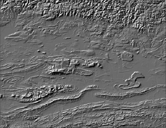
Shaded relief map of the Arkansas River Valley. Canoe and cigar-shaped structures represent anticlines and synclines.
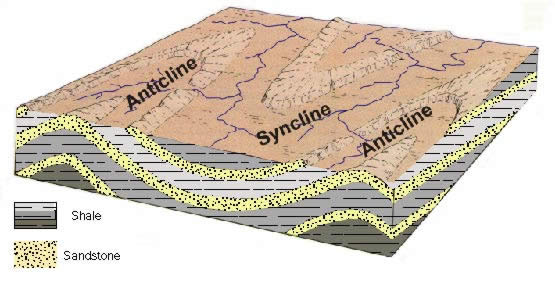
Diagram showing structures in the river valley. Most of the higher elevations exposed in the river valley are actually what is left of the center if the syncline. Nearly all of the rocks from the surrounding anticlinal limbs have been eroded away.
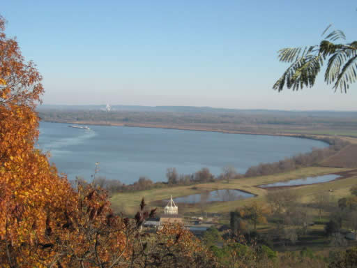
The Arkansas River and surrounding low-lying land as seen from Petit Jean Mountain
Sandstone and shale on Magazine Mountain
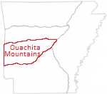
Ouachita Mountains Province
The Ouachita Mountains consists of a series of sharp ridges, mostly east-west trending and often buckled and distorted, separated by narrow to broad valleys. Surface rocks from this province are mostly shales, sandstone, novaculite, chert and minor limestone.
Shaded relief map of the Arkansas River Valley. Canoe and cigar-shaped structures represent anticlines and synclines.
Geology of the Ouachita Mountains
The Ouachita Mountain contains thick sequences of sedimentary rocks deposited in a deep ocean basin that have been uplifted and compressed northward into east-west trending complex folds (anticlines and synclines) and thrust faults due to major orogenic (mountain building) processes. The most intensely deformed area is in the central portion of the fold belt.
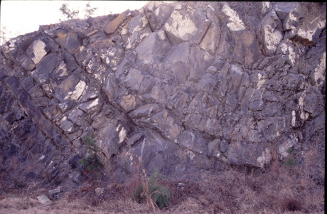
Synlinal fold in rocks near Hot Springs Arkansas
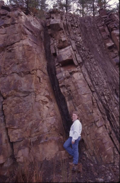
Vertical bedding at Y-City
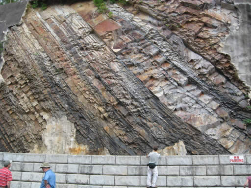
Inclined bedding in the Stanley Shale in Hot Springs Arkansas
Folded strata in the Big Fork Chert near Hot Springs
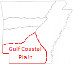
West Gulf Coastal Plain Province
The West Gulf Coastal Plain is a south sloping plain of gently rolling hills and can be divided into two areas based on the age of the rocks. The area in orange consists of Tertiary clays, sands and silts with lignite deposits and Quaternary gravels, sands and clays.
The area in green consists of Cretaceous sand, clay, gravel, marl, limestone, chalk and Quaternary sand and gravel.
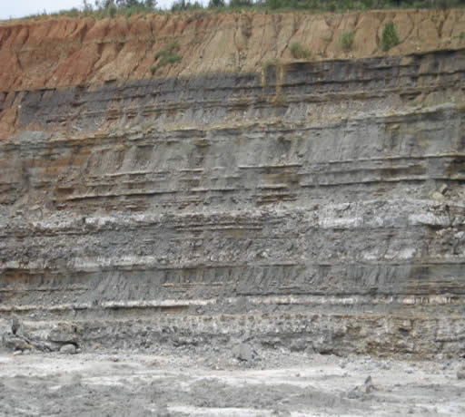
Geology of the Tertiary Area
This part of the state contains mostly early Tertiary aged rocks, mostly sands, silts and clays, deposited in streams, swamps and shallow marine water. Lignite beds occur throughout the sequence. Quaternary alluvium and terrace deposits are present from rivers in the area. Underneath the Tertiary deposits are the sands, gravels, limestones, chalks and marls seen in the Cretaceous area.
Wilcox sand and clays with lignite beds.
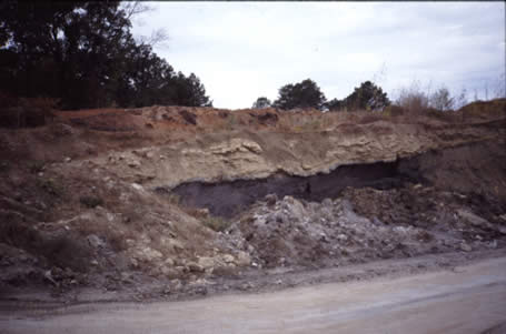
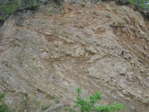
Tertiary outcrop near Little Rock
Geology of the Cretaceous Area
The geology of the Cretaceous area within the West Gulf Coastal Plain is characterized by gently southward-dipping sedimentary rocks deposited mostly in shallow marine water of the Gulf of Mexico that once extended into Arkansas. Alluvium deposits from older and present day streams are common
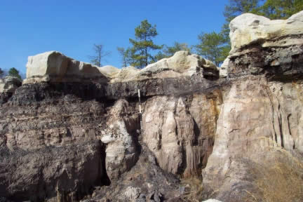
The Annona Formation at Whitecliffs near Millwood Lake
Gypsum beds in the DeQueen Limestone
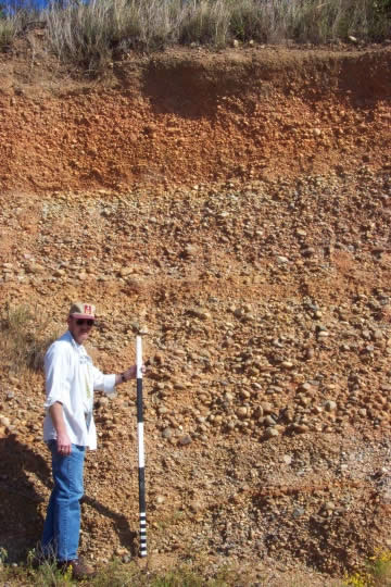
Tokio Gravel
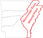
Mississippi River Alluvial Plain Province
The Mississippi River Alluvial Plain is a relatively level plain with elevations varying between 100-300 feet except for Crowley’s Ridge with some of its highest points reaching 400-560 feet. This province contains mostly unconsolidated sediments such as sand, clay, silt, gravel and loess.
Geology of the Mississippi River Alluvial Plain
The geology of the Mississippi River Alluvial Plain is characterized by unconsolidated flat-lying alluvium from present day and older streams, overlying poorly consolidated Tertiary formations that are dipping slightly to the south.
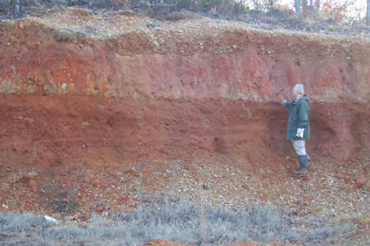
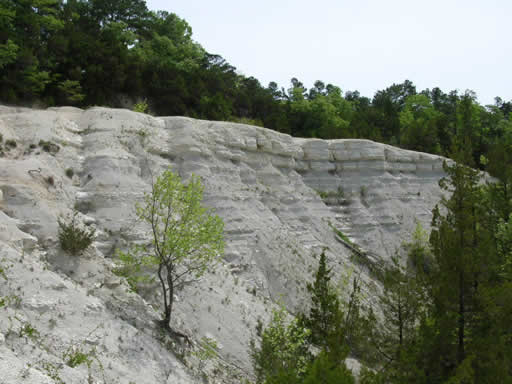
Quaternary terrace sand and gravels on top of Crowley’s Ridge
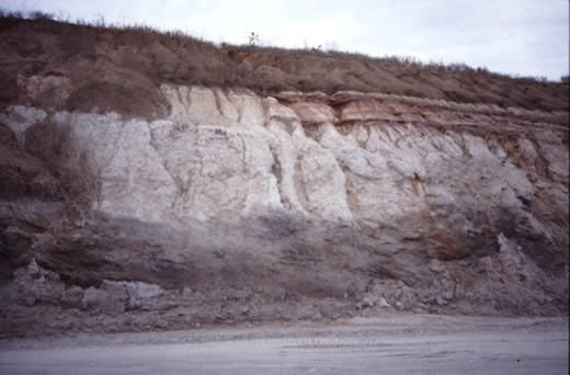
Tertiary deposits
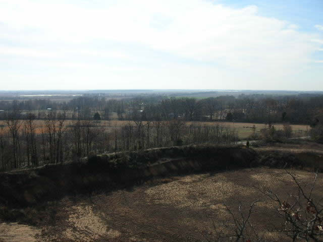
View of flat-lying alluvial plain
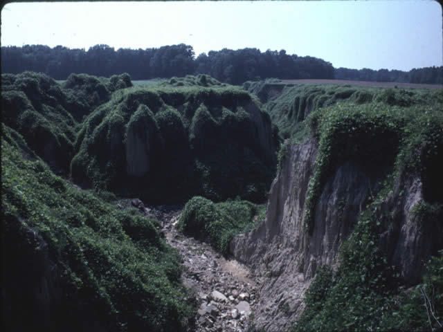
Loess canyon on Crowley’s Ridge