.jpg)
.jpg)
.jpg)
Stratigraphy
Extracted with minor revisions from AGS Information Circular 36.
This summary of the stratigraphic section of Arkansas is intended to be a companion document for the Geologic Map of Arkansas (1976, 1993). It offers a brief description of each of the units depicted on the state geologic map. Some stratigraphic units combined on the Geologic Map of Arkansas are treated independently herein. A few units that are not specifically listed on the legend of the state geologic map are treated separately because of their outcrop prominence or importance for stratigraphic understanding. Some units depicted on the Geologic Map of Arkansas are not formal stratigraphic formations, but rather are descriptive references: nevertheless, a brief description is herein provided. Most of these latter units are Quaternary subdivisions that have not yet been studied in detail. Some information contained in this document is at variance with the data presented on the Geologic Map of Arkansas due to more recent observations and interpretations.
Each listing relates the general geology of each unit along with auxiliary information relating to the unit’s age, distribution, original reference, and type locality. The information provided for each formation under the Geology heading consists of a brief statement relating to the dominate lithologies and characteristics of the unit, its fossil fauna, conformity of the lower contact, and thickness on the outcrop. If a unit has well known subdivisions, they are usually treated within this section. The Age of each formation is listed by geologic Period often with some indication of conventional subdivision, such as Early, Middle, and Late, or an Epoch name. The Distribution of each formation is presented with reference to the general area in Arkansas where the unit outcrops. If the unit is known outside of Arkansas, the other states are listed following the information about Arkansas. The Original reference is the citation for the original publication defining the unit. The Type locality information is usually the type area of the formation rather than a specific type locality. Many of these formations were defined before the practice of designating a type locality became a part of proper stratigraphic description.
This document is broken into four sections, which may be accessed by clicking on the links:
- the Ozark Plateaus
- the Ouachitas including the Arkansas River Valley
- the Mississippi River Alluvial Plain and Gulf Coastal Plain
- Igneous
Some units are recognized in more than one section of the state and are listed in all sections that apply. The order of the descriptions is the same as the stratigraphic sequence, oldest to youngest. The stratigraphic units (listed herein) that are printed in italics are in dispute.
The information compiled in this document was derived from many sources, both personal and published. Along with the references listed below, Arkansas Geological Survey staff members Doug Hanson, Boyd Haley, Mike Howard, Bill Prior, Charles Stone, and the author provided data from their personal researches into the various regions and strata.
A majority of the descriptions for the formations in the Ozark Plateaus region are taken from the Stratigraphic Summary of Arkansas by John David McFarland (1998), IC-36.
This summary of the stratigraphic section of Arkansas is intended to be a companion document for the Geologic Map of Arkansas (1976, 1993). It offers a brief description of each of the units depicted on the state geologic map. Some stratigraphic units combined on the Geologic Map of Arkansas are treated independently herein. A few units that are not specifically listed on the legend of the state geologic map are treated separately because of their outcrop prominence or importance for stratigraphic understanding. Some units depicted on the Geologic Map of Arkansas are not formal stratigraphic formations, but rather are descriptive references: nevertheless, a brief description is herein provided. Most of these latter units are Quaternary subdivisions that have not yet been studied in detail. Some information contained in this document is at variance with the data presented on the Geologic Map of Arkansas due to more recent observations and interpretations.
Each listing relates the general geology of each unit along with auxiliary information relating to the unit’s age, distribution, original reference, and type locality. The information provided for each formation under the Geology heading consists of a brief statement relating to the dominate lithologies and characteristics of the unit, its fossil fauna, conformity of the lower contact, and thickness on the outcrop. If a unit has well known subdivisions, they are usually treated within this section. The Age of each formation is listed by geologic Period often with some indication of conventional subdivision, such as Early, Middle, and Late, or an Epoch name. The Distribution of each formation is presented with reference to the general area in Arkansas where the unit outcrops. If the unit is known outside of Arkansas, the other states are listed following the information about Arkansas. The Original reference is the citation for the original publication defining the unit. The Type locality information is usually the type area of the formation rather than a specific type locality. Many of these formations were defined before the practice of designating a type locality became a part of proper stratigraphic description.
Ozark Plateaus Region
The Ozark Plateaus region of Arkansas is made up of generally flat-lying Paleozoic age strata divided into three plateau surfaces. The lowest and northern-most plateau is the Salem Plateau and is generally underlain by dolostones, sandstones, and limestones of Ordovician age. The Springfield Plateau stands above the Salem a few hundred feet and is generally capped by lower Mississippian age limestones and cherts. The southernmost and highest plateau of the Ozarks is the Boston Mountains. It is dominated by Pennsylvanian age shales, siltstones, and sandstones. All of these plateaus are deeply dissected by numerous streams throughout the area. The faulting in the Ozarks is generally normal; most faults displaying a displacement down on the southern side. However, some observations reveal that a few strike-slip faults may be present. Gentle folds are noted but are generally of very low amplitude. The depositional environment of the rocks found in the Arkansas Ozarks is one of a relatively shallow continental shelf, sloping toward deeper water generally toward the south. This shelf emerged many times during the Paleozoic resulting in numerous unconformities throughout the sequence.
Each description is listed under its corresponding time period in order from oldest to youngest.
Summary of Igneous Rocks
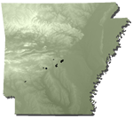
The majority of exposures of igneous rocks in Arkansas are present in Pulaski, Saline, Hot Spring, and Garland Counties. Scattered small peridotite-carbonatite dikes, breccia pipes, and sills are exposed in the Arkansas Valley, and a single outcrop of igneous rock with ultramafic affinities is known in the Boston Mountains. The total mapped area of the various exposures encompasses less than 15 square miles.
The largest of these bodies is a partially buried batholith composed of varieties of nepheline syenite that was exposed by erosion in both Pulaski and Saline Counties (Granite Mountain and Saline County intrusions). The Magnet Cove ring-dike and the Potash Sulphur Springs complex in Hot Spring and Garland Counties, respectively, are more mafic in composition, contain a greater variety of rock types, and had different structural styles of intrusion than the Pulaski/Saline County batholith. Several small explosive vents containing diamondiferous lamproite breccia and magmatic lamproite (formerly termed kimberlite breccia and peridotite, respectively) are present in Pike County. Numerous mafic and alkalic dikes are present in the eastern Ouachitas.
All of the rocks mentioned above that have been dated by stratigraphic or isotopic methods are Cretaceous in age, ranging from 87 to 105 million years old. Small bodies of metagabbro and serpentine/soapstone exposed in Saline and Pulaski Counties represent altered ultramafic rock units which date from the late Precambrian Era (~one billion years). These bodies were emplaced into the Ouachita Mountains sedimentary sequence as solid masses during the Paleozoic Era.
References
Berry, E. W., 1915, Erosion Intervals in the Eocene of the Mississippi Embayment: U. S. Geological Survey Professional Paper 95-F.
Clardy, B. F., 1979, Arkansas Lignite Investigations, Preliminary Report: Arkansas Geological Commission Miscellaneous Publication 15.
Craig, W. W., Wise, O., and McFarland, J. D., 1984, A Guidebook to the Post-St. Peter Ordovician and the Silurian and Devonian Rocks of North-Central Arkansas: Arkansas Geological Commission Guidebook 84-1.
Croneis, C., 1930, Geology of the Arkansas Paleozoic Area: Arkansas Geological Commission Bulletin 3.
Dane, C. H., 1929, Upper Cretaceous Formations of Southwestern Arkansas: Arkansas Geological Commission Bulletin 1.
Gordon, M. Jr., Tracey, J. I., and Ellis, M. W., 1958, Geology of the Arkansas Bauxite Region: U. S. Geological Survey Professional Paper 299.
Guccione, M. J., Prior, W. L., and Rutledge, E. M., 1986, The Tertiary and Quaternary Geology of Crowley’s Ridge: Arkansas Geological Commission Guidebook 86-4.
Haley, B. R., et al., 1976, 1993 (revised), Geologic Map of Arkansas: Arkansas Geological Commission.
Harris, G. D., 1894, The Tertiary Geology of Southern Arkansas: Annual Report of the Geological Survey of Arkansas for 1892, Volume II.
Hill, R. T., 1888, The Neozoic Geology of Southwestern Arkansas: Annual Report of the Geological Survey of Arkansas for 1888, Volume II.
Keroher, G. C., 1966, Lexicon of Geologic Names of the United States for 1936-1960: U. S. Geological Survey Bulletin 1200.
Keroher, G. C., 1970, Lexicon of Geologic Names of the United States for 1961-1967: U. S. Geological Survey Bulletin 1350.
Saucier, R. T., 1994, Geomorphology and Quaternary Geologic History of the Lower Mississippi Valley: U. S. Army Engineer Waterways Experiment Station, Vicksburg, Mississippi.
Sutherland, P. K. and Manger, W. L., 1977, Upper Chesterian-Morrowan Stratigraphy and the Mississippian-Pennsylvanian Boundary in Northeastern Oklahoma and Northwestern Arkansas: Oklahoma Geological Survey Guidebook 18.
Sutherland, P. K. and Manger, W. L., 1979, Mississippian-Pennsylvanian Shelf-to-Basin Transition Ozark and Ouachita Regions, Oklahoma and Arkansas: Oklahoma Geological Survey Guidebook 19.
Wilbert, L. J., 1953, The Jacksonian Stage in Southeastern Arkansas: Arkansas Geological Commission Bulletin 19.
Wilmarth, M. G., 1938, Lexicon of Geologic Names of the United States: U. S. Geological Survey Bulletin 896.