
Ordovician
Jefferson City Dolomite/Formation
Age: Early Ordovician Period
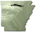
Distribution: Northern Arkansas, Ozark Plateaus; Missouri
Geology: The Jefferson City consists of light- to dark-tan, fine-grained, crystalline dolostone and considerable chert with some rare thin beds of sandstone, shale, and oolite. Few fossils are known from the formation. The Jefferson City Dolomite unconformably overlies the Roubidoux Formation. This lower contact is not exposed in Arkansas. The Jefferson City Formation has not been successfully differentiated from the Cotter Formation in Arkansas.
Original reference: A. Winslow, 1894, Missouri Geol. Survey, v. 6, p. 331, 373, 375.
Type locality: Named for exposures at Jefferson City, Cole County, Missouri
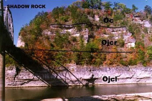
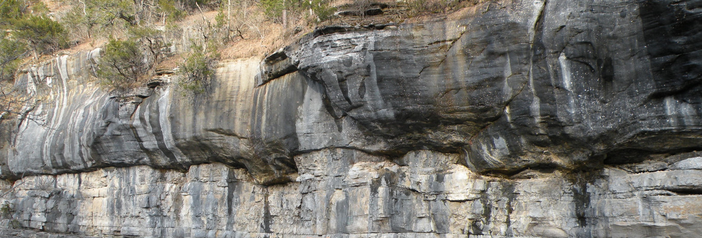
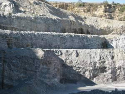
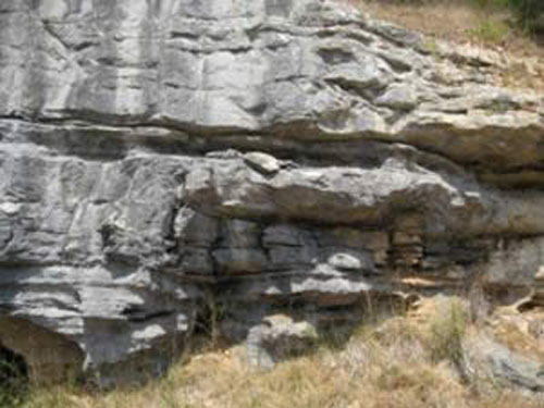
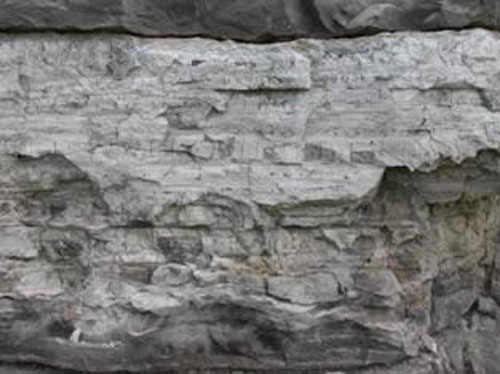
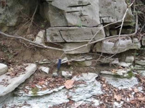
Cotter (Oc) and Jefferson City Dolomites in Forsyth Missouri in Taney County. (from Missouri Geological Survey)
Ojcr – Rockaway Conglomerate (informal member of Jefferson City)
Ojcl – Jefferson City lower
Cotter Dolomite/Formation
Age: Early Ordovician Period
Distribution: Northern Arkansas, Ozark Plateaus; southern Missouri, and Oklahoma
Geology: The Cotter Dolomite is composed of dolostone of predominantly two types: a fine-grained, argillaceous, earthy textured, relatively soft, white to buff or gray dolostone called "cotton rock", and a more massive, medium-grained, gray dolostone that weathers to a somewhat hackly surface texture and becomes dark on exposure. The formation contains chert, some minor beds of greenish shale, and occasional thin interbedded sandstone. The chert nodules associated with the Cotter frequently have concentric light and dark bands. The fossils known from the Cotter Dolomite are rare, but include gastropods, cephalopods, and reef-building algae. To date, there has been no success in differentiating the Cotter Formation from the Jefferson City Formation in Arkansas, although the contact is considered disconformable. The thickness is about 340 feet in the vicinity of Cotter, but the interval may range up to 500 feet thick in places.
Original reference: A. H. Purdue and H. D. Miser, 1916, U.S. Geol. Survey Geol. Atlas, Folio 202.
Type locality: Starting at valley bottom just upstream from west end of the old White River bridge at Cotter and extending to top of hill westward along the old U.S. Highway 62, Baxter County, Arkansas
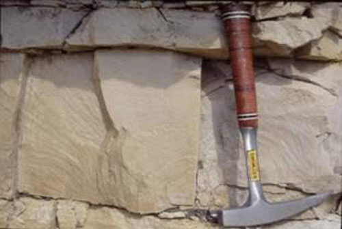
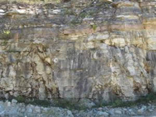
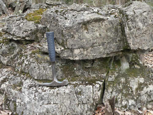
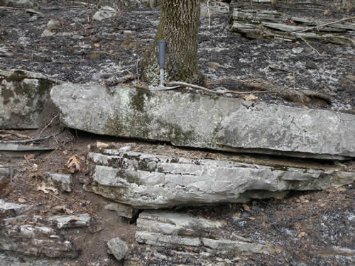
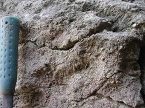
Dolostone in the Cotter Formation, Cotter, Arkansas
Quartz and calcite vugs in the Cotter Formation, cotter, AR
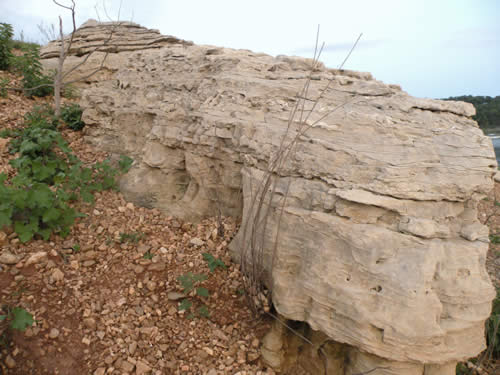
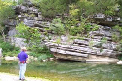
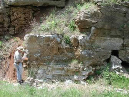
Cotter Formation at Dimaond City, AR
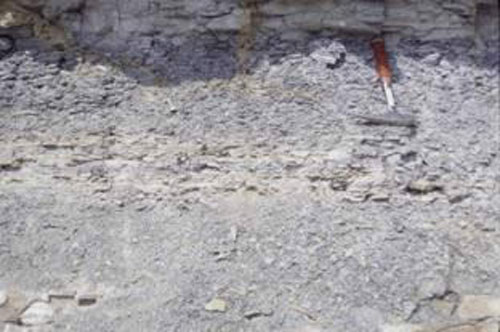
Cotter chert, Williams Creek
Powell Dolomite/Formation

Age: Early Ordovician Period
Distribution: Northern Arkansas, Ozark Plateaus; southeastern Missouri
Geology: The Powell Dolomite is generally a fine-grained, light-gray to greenish-gray, limy, argillaceous dolostone with thin beds of shale, sandstone, sandy dolostone, and occasionally chert. In the lower half of the formation a dark massive ledge with abundant drusy quartz has been located in many areas. A conglomerate occurs at the base of the formation in most places. The Powell Dolomite is not known to contain many fossils, although gastropods, cephalopods, and trilobites have been reported. The lower contact with the Cotter is disconformable. The formation’s thickness may be as much as 215 feet, but is often much thinner.
Original reference: A. H. Purdue and H. D. Miser, 1916, U. S. Geol. Survey Geol. Atlas, Folio 202.
Type locality: Name derived from Powell Station, now abandoned, on Missouri-Pacific Railroad about 2 miles down stream on Crooked Creek from present village of Pyatt, Marion County, Arkansas
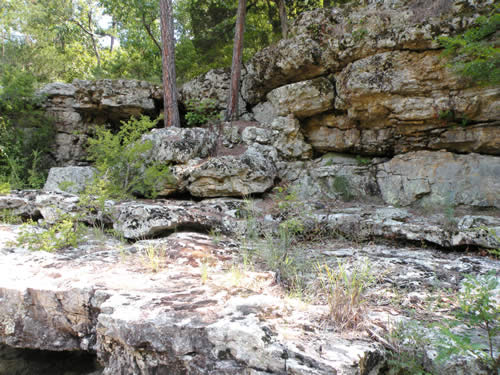
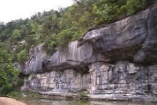
Powell Formation in Black Rock Arkansas
Shales in the Powell Formation near Yellville
Powell Formation
Everton Formation
Age: Middle Ordovician Period
Distribution: Northern Arkansas, Ozark Plateaus; southern Missouri
Geology: The Everton Formation shows considerable differences in lithologic character from one place to another. It is composed of various mixtures of dolostone, sandstone, and limestone. The formation also has traces of conglomerate, shale, and chert in limited areas. The limestones are light-gray to brownish-gray and are generally more or less dolomitic and sandy. The dolostones are light- to dark-gray and generally more or less limy and sandy. The Everton Formation has thick members of friable, sandstone dominating local sections in the different regions. These sands tend to be made up of white, well-rounded, frosted, medium-sized grains and are almost indistinguishable from the overlying St. Peter Sandstone when observed out of context. It is not unusual for one lithology to grade into another along the bedding. Bedding throughout this unit is thin to massive. Named members include the Newton Sandstone, the Calico Rock Sandstone, and the Kings River Sandstone. Fossils are not common in the formation. However, ostracods, cephalopods, gastropods, bivalves, trilobites, and bryozoans are noted. The lower contact is unconformable and other disconformities occur within the formation. The thickness of the Everton Formation varies from about 300 feet to as much as 650 feet.
Original reference: A. H. Purdue, 1907, Geol. Soc. America Bull., v. 18, p. 251-256.
Type locality: Named from Everton, Boone County, Arkansas
Dolostone in the Everton Formation near Landis Arkansas
Interbedded sandstone and dolostones near Everton Arkansas
St. Peter Sandstone/Formation
Age: Middle Ordovician Period
Distribution: Northern Arkansas, Ozark Plateaus; Illinois, Indiana, Iowa, Kansas, Kentucky, Michigan, Minnesota, Missouri, Ohio, Oklahoma, and Wisconsin
Geology: The St. Peter Sandstone is generally a massive bedded, medium- to fine-grained, well- rounded, friable, white sandstone. A few minor beds of shale, limestone, and/or dolostones have been noted in places. The cement is commonly calcite often with single crystals incorporating hundreds to thousands of sand grains. The unit is a frequent bluff-former. Crossbedding and ripple marks are rare. No body fossils are known from the formation in Arkansas, but a few trace fossils have been reported. The base of the St. Peter Sandstone is unconformable, often with several feet of relief. The formation ranges from a feather edge to as much as 175 feet thick.
Excerpt from map description: A fine to medium-grained, angular to rounded, well sorted, calcite-cemented sandstone. Usually case hardened but friable when broken. Light tan to white on fresh surface but weathers gray to dark tan. Thick to massive bedded and commonly displays a concave or convex rounded ledge. Commonly forms "balds" or glades but can also forms bluffs along creeks. Contains vertical worm tubes (Skolithos) that resemble icicles. Cylindrical columns of sandstone referred to as "sandstone pipes" (Purdue and Miser, 1916) can be seen at various localities. These sandstone pipes vary in size from 1 inch in diameter to 6 feet in diameter. Sometimes just the upper surface is exposed; however, vertical sections were seen in bluff faces. Unconformable with the underlying Everton Formation. Approximately 20 - 300 ft. thick.
Original reference: D. D. Owen, 1847, Preliminary Report. of the Geological Survey of Wisconsin and Iowa: U. S. Gen. Land Office Report 1847 (U. S. 30th Cong., 1st Session. S. Ex. Doc. 2), p. 169, 170.
Type locality: At Fort Snelling, Hennepin County, Minnesota. Named for exposures on St. Peter River, now called Minnesota River, southern Minnesota
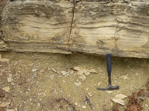
Contact (in middle of rock outcrops) between St. Peter Sandstone and Everton Formation. First picture is from Gunner Pool on the Onia Quadrangle. Second picture is on Big Creek on the Landis Quadrangle.
Joachim Dolomite/Formation
Age: Middle Ordovician Period
Distribution: Northern Arkansas, Ozark Plateaus; eastern Missouri and southwestern Illinois
Geology: The Joachim Dolomite is chiefly a fine-grained dolostone and dolomitic limestone with thin beds of shale. Some thin sandstones occur near its base and some of the carbonates are sandy in places. Supratidal deposits are frequent and display mud cracks, calcite pseudomorphic after halite hopper crystals, and laminated horizons. A few bivalves have been collected from the lower part of the formation. The Joachim Dolomite rests conformably on the St. Peter Sandstone. The formation is absent in the west, but may attain thicknesses of over 100 feet.
Original reference: A. Winslow, 1894, Missouri Geol. Survey, v. 6, p. 331, 352.
Type locality: Named for exposures along Joachim Creek, Jefferson County, Missouri
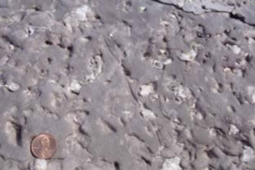
Dolostone in the Joachim Formation containing mudcracks exposed along Highway 14 near Mountain View
Joachim Formation along Rand Road
Plattin Limestone/Formation
Age: Middle Ordovician Period
Distribution: Central northern Arkansas, Ozark Plateaus; eastern Missouri and western Illinois
Geology: The Plattin is a very fine-grained, light- to dark-gray, micritic limestone in mostly thin beds. Medium- and coarse-grained limestone beds are rare. Traces of rounded and frosted quartz sand are found in some beds. The limestone often has small blebs of calcite. The formation commonly breaks with conchoidal fracture and is noted for not supporting lichens to any great extent. Fossils are common to some upper beds, most notably Tetradium coral fragments and colonies. The lower contact of the Plattin Limestone is disconformable. The formation may reach as much as 250 feet thick, but is usually much thinner.
Original reference: E. O. Ulrich, 1904, Missouri Bur. Geology and Mines, v. 2, 2d ser., p. 111.
Type locality: Named for exposures near mouth of Plattin Creek, Jefferson County, Missouri
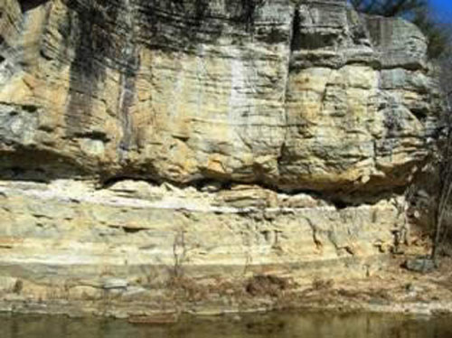
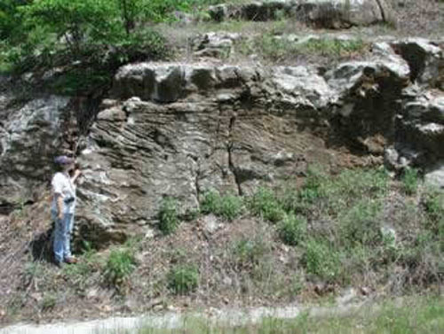
Dipping Plattin in Fiftysix quadrangle
Plattin Formation including shale beds near Gilbert
Dipping Plattin Formation
Kimmswick Limestone/Formation
Age: Middle Ordovician Period
Distribution: Northern Arkansas, Ozark Plateaus; eastern Missouri and southwestern Illinois
Geology: The formation is chiefly an even-bedded, thin to massive, light- to pinkish-gray, fine- to coarse-grained, bioclastic limestone with a characteristic surgary texture. Some beds of dolostone and sandstone have been noted. The grains of the rock are normally a well mixed accumulation of fossil fragments including corals, bryozoans, brachiopods, trilobites, crinoids, and mollusks. The lower boundary displays a "welded," disconformable contact with the Plattin Limestone and displays an angular relationship with it in at least one place. The Kimmswick Formation ranges from 0 to 55 feet in thickness.
Original reference: E. O. Ulrich, 1904, Missouri Bur. Geology and Mines, V. 2, 2d ser., p. 111.
Type locality: Named for exposures at Kimmswick, Jefferson County, Missouri
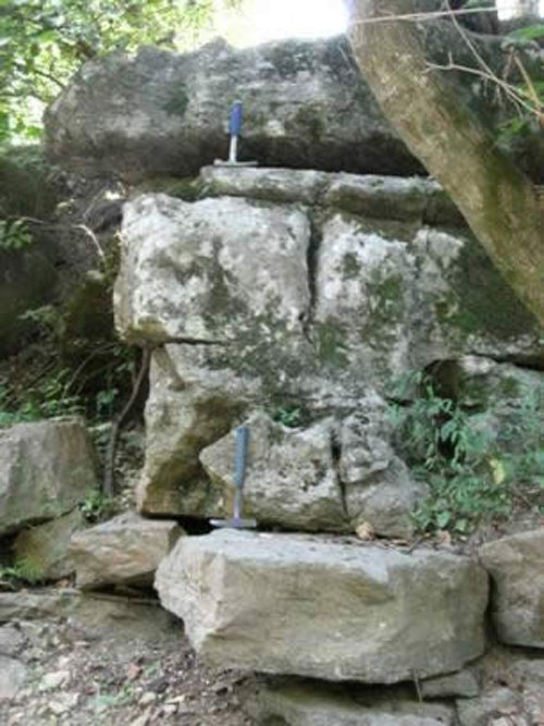
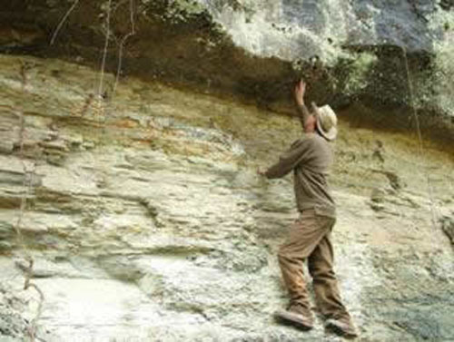
Kimmswick Limestone. The highest hammer is sitting on the top of the Kimmswick at the contact with the overlying Fernvale Limestone. The lower hammer is resting on the Plattin Limestone at the contact of the base of the Kimmswick.
The top of the Kimmswick is above geologist’s head level between the Fernvale Limestone and the Plattin Limestone (basal contact near geologist waist level).
Fernvale Limestone/Formation
Age: Late Ordovician Period
Distribution: Northern Arkansas, Ozark Plateaus; western Tennessee, northwestern Alabama, southwestern Illinois, southeastern Missouri, and central, eastern, and northeastern Oklahoma
Geology: The Fernvale Limestone is generally a massive, sometimes cross-bedded, coarsely crystalline, light-gray to pink, crinoidal limestone. This unit may appear quite similar to the underlying Kimmswick in some sections. Barrel-shaped crinoid columnals are found in many sections of the formation. The Fernvale Limestone is sometimes vuggy and often contains traces of bluish to olive-gray clays. Fossils are found throughout the unit and an interval at the top of the formation is often present that contains orthoconic nautiloids. Other fossils present include brachiopods, bryozoans, and crinoids. The basal contact is a "welded" disconformity. The formation ranges in thickness from 0 to over 100 feet.
Original reference: C. W. Hayes and E. O. Ulrich, 1903, U. S. Geol. Survey Geol. Atlas, Folio 95, p. 2.
Type locality: Named for Fernvale, Williamson County, Tennessee
Barrel shaped crinoids in the Fernvale Limestone
The Fernvale Limestone is exposed along Roasting Ear Road and contains cross-bedding
Cason Shale/Formation
Age: Late Ordovician Period, (and Early/Middle Silurian Period)
Distribution: Northern Arkansas, Ozark Plateaus
Geology: The Cason Shale consists of several rock types: phosphatic sandstone and shale, oolitic limestone, pelmatozoan limestone (Brassfield Limestone), and sandy, calcareous shale containing flattened algal "buttons" (oncolites). The sequence is usually blue-green to dark gray colored. (Some modern workers place the Brassfield Limestone as a member of the Cason Shale below the "button" shale and above the phosphatic sandstone and shale.) Phosphatic brachiopods are found in some beds and other fossil fragments are common. Agglutinated foraminifera and conodonts have been identified from acid residues. The formation is disconformable on the underlying beds and may contain at least two other unconformities. At no place is the entire Cason Formation's sequence preserved. The Cason Shale is not known to be much more than 23 feet thick in any one place and usually much thinner.
Original reference: H. S. Williams, 1894, Am. Jour. Sci., 3d, v. 48, p. 325-331.
Type locality: Named for Cason tract, near Batesville, Independence County, Arkansas
Basal Mississippian sandstone sitting on Cason Shale near Gilbert Arkansas
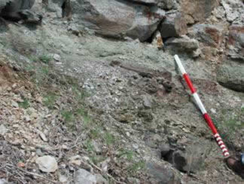
Cason Shale (at staff level) in Independence County
References
Purdue, A. H. and Miser, H. D., 1916, Eureka Springs-Harrison Folio, Arkansas Missouri: U.S. Geological Survey Geologic Atlas of the United States, no. 202, 82 p.