Stratigraphic Summary of the Arkansas River Valley and Ouachita Mountains
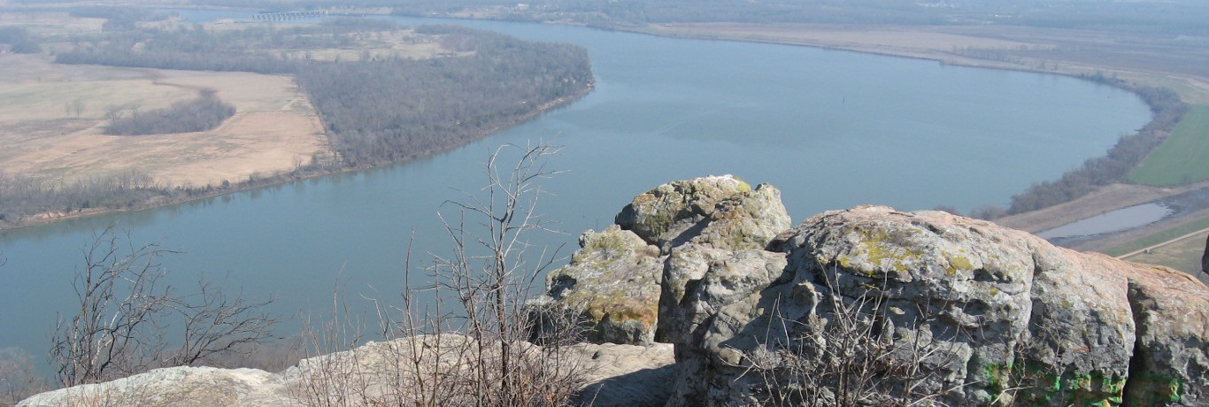
The Arkansas Valley is dominated by Pennsylvanian clastic sediments deposited on the margin of a continental shelf primarily by deltas and reorganized in part by marginal marine processes. Structurally the area is made up of broad synclines with relatively narrow intervening anticlines. The axes of these folds generally trend east-west. Most of the observed faulting is normal, but some thrusts faults are noted, associated with the anticlines in the southern part of the province. The synclines are often the most conspicuously present positive topographic features, formed from more rapid erosion of underlying shales, once capping sandstones were breached on the crests and flanks of the surrounding anticlines.
The Ouachita Mountains are made up of complexly folded and faulted Paleozoic age sedimentary rocks that were originally deposited in mostly deep marine environments. The continental collision during the late Paleozoic that pushed up this region produced a structural fabric that trends more or less east-west. The folding was intricate at all scale levels and several local sequences, both complete and partial, are overturned. Compressional faulting is commonly expressed in the sequence throughout the area. The Ouachita province, in a general sense, can be considered an anticlinorum with Late Cambrian and Ordovician deposits being exposed in the center and Mississippian and Pennsylvanian sedimentary units exposed around the margins. The area is cut off to the east by the Gulf Coastal Plain and Mississippi Embayment.
Stratigraphic correlation charts for the Ouachita Mountains/Arkansas Valley and Ozark Plateaus subregions of the interior highlands region of Arkansas
Collier Shale/Formation

Age: Late Cambrian Period and Early Ordovician Period
Distribution: West-central Arkansas, Ouachita Mountains (principally Montgomery and Garland Counties); southeastern Oklahoma
Geology: The sequence is composed of gray to black, lustrous shale containing occasional thin beds of dense, black, and intensely fractured chert. An interval of bluish-gray, dense to spary, thin-bedded limestone may be present. Near its top, the limestone is conglomeratic and pelletoidal, in part, with pebbles and cobbles of limestone, chert, meta-arkose, and quartz. The entire unit displays intensive deformation and frequent small quartz veins. Fossils are rare, but include trilobites and conodonts. The base of the formation is not exposed, but the total thickness exposed exceeds 1000 feet.
Original reference: A. H. Purdue, 1909, Geological Society of America Bulletin v. 19, p. 557; A. H. Purdue, 1909, Slates of Arkansas: Arkansas Geological Survey, p. 30, 31.
Type locality: Named for Collier Creek, Montgomery County, Arkansas
Crystal Mountain Sandstone/Formation
Age: Early Ordovician Period
Distribution: West-central Arkansas, Ouachita Mountains (principally Montgomery and Garland Counties); southeastern Oklahoma
Geology: The formation is typically composed of massive, coarse-grained, well-rounded, light-gray sandstone. Lesser amounts of interbedded light-gray to gray shale, black chert, bluish-gray limestone, and gray calcareous conglomeratic sandstone (often containing clasts of meta-arkose) are usually present. Some large boulders of meta-arkose and other exotics occur in some slurried conglomerate intervals. The unit is often set with a network of quartz veins up to several inches thick. In some places the quartz veins are open (up to several feet wide) allowing clusters of quartz crystals to form. Conodonts are present in this formation. The contact with the underlying Collier Shale is considered conformable. Typical thicknesses of the unit range from 500 to 850 feet, but some sites may have less than 50 feet.
Original reference: A. H. Purdue, 1909, Geological Society of America Bulletin v. 19, p. 557; A. H. Purdue, 1909, Slates of Arkansas: Arkansas Geological Survey, p. 30, 32.
Type locality: Named for the Crystal Mountains, Montgomery County, Arkansas
Mazarn Shale/Formation
Age: Early Ordovician Period
Distribution: West-central Arkansas, Ouachita Mountains; southeastern Oklahoma
Geology: The formation is predominantly shale with small amounts of siltstone, silty to conglomeratic sandstone, limestone, and glossy black chert. The shale is mostly gray-black, but thin layers of olive-gray silty shale or siltstone are interbedded with the darker shales in some sequences. When the dark and greenish shales are cleaved at an angle to bedding, they yield a ribboned surface. In many places quartzose siltstone or very fine-grained sandstone is present. Dense, bluish-gray, thin-bedded limestones may be present throughout the interval. Thin to thick beds of gray sandstone are occasionally found at random horizons, notably in the upper and lower portions of the sequence. The cherts are usually found in the upper part of the unit. Milky quartz veins are common in some areas. Only conodonts and a few graptolites have been noted. The unit is conformable with the underlying Crystal Mountain Sandstone. The thickness of the Mazarn Shale ranges from 1000 feet to over 2500 feet.
Original reference: H. D. Miser, 1917, U. S. Geological Survey Bulletin, V. 660, p. 68.
Type locality: Named for Mazarn Creek (headwaters), eastern Montgomery County, northeastern Caddo Gap Quadrangle, Arkansas
Blakely Sandstone/Formation
Age: Middle Ordovician Period
Distribution: West-central Arkansas, Ouachita Mountains; southeastern Oklahoma
Geology: The formation consists of black and green shale in alternating layers with hard, gray sandstone and some bluish-gray limestone. Although the shale may locally make up 50 to 75 percent of the sequence, the sandstones appear dominant due to their erosion resistance. The sandstones are light-gray to blue, medium-grained, well-cemented, and in thin to thick beds. Silica or calcite may be present as cement. Where the cement is silica the sandstone is quartzite and is quite resistant to weathering. Erratic meta-arkose boulders and pebbles occur in some conglomeratic sandstones. The shales of the Blakely are sometimes ribboned much like the Mazarn shales. Graptolites and conodonts are the fossils reported from the formation. The lower contact is considered conformable. The thickness ranges from a few feet to about 700 feet.
Original reference: E. O. Ulrich, 1911, Geological Society of America Bulletin, V. 22, p. 676.
Type locality: Named for Blakely Mountain, Garland County, Arkansas
Womble Shale/ Formation
Age: Middle Ordovician Period
Distribution: West-central Arkansas, Ouachita Mountains; southern Oklahoma
Geology: The Womble Formation is mostly black shale with thin layers of limestone, silty sandstone, and some chert. Some green shales are interbedded with the black shales, but less so than in the Mazarn Shale. Cleavage, at an angle to bedding, frequently displays ribboned cleavage surfaces. The sandstones are dark-gray, compact, fine-grained, occasionally conglomeratic, and may be phosphatic. These sandstones are generally present in the lower part of the formation. Dense, blue-gray limestones usually occur near the top of the formation in thin to medium beds. Black chert also is present as thin layers at the top of the formation. Large milky quartz veins often fill fractures in the formation. Graptolite and conodont fossils have been noted from the Womble Shale. The formation rests conformably on the underlying Blakely Sandstone and ranges from 500 to 1200 feet in thickness.
Original reference: H. D. Miser, 1917, U. S. Geological Survey Bulletin 600, p. 67
Type locality: Named for the town of Womble (now called Norman) in Montgomery County, Arkansas
Bigfork Chert/Formation
Age: Middle and Late Ordovician Period
Distribution: West-central Arkansas, Ouachita Mountains; southeastern Oklahoma
Geology: The Bigfork Chert consists of thin-bedded, dark-gray, cryptocrystalline chert interbedded with varying amounts of black siliceous shale, calcareous siltstone, and dense, bluish-gray limestone. The cherts normally occur in thin to medium beds and are usually highly fractured. The interbedded siliceous shales occur in thin to thick sequences and are often pyritic. Limestones occur mostly as interbeds in the chert and typically weather to soft brown layers. The limestones are more common in the northwestern exposures. Fossils are rare, but fragments of brachiopods, crinoids, sponges, conodonts, and graptolites have been reported. The contact between the Bigfork Chert and the underlying Womble Shale is conformable. The Bigfork in Arkansas ranges in thickness from about 450 feet in the northern Ouachitas to about 750 feet in the southern Ouachitas.
Original reference: A. H. Purdue, 1909, Geological Society of America Bulletin v. 19, p. 557; A. H. Purdue, 1909, Slates of Arkansas: Arkansas Geological Survey, p. 30, 35.
Type locality: Named for exposures near the Bigfork Post Office, Montgomery County, Arkansas
Polk Creek Shale/Formation
Age: Late Ordovician Period
Distribution: West-central Arkansas, Ouachita Mountains; southeastern Oklahoma
Geology: The Polk Creek rocks are black, sooty, fissile shale with minor black chert and traces of gray quartzite and limestone. Graptolites are common in most of the shales in the formation. The Polk Creek Shale rests conformably on the Bigfork Chert. Its thickness ranges from about 50 to 225 feet.
Original reference: A. H. Purdue, 1909, Geological Society of America Bulletin v. 19, p. 557; A. H. Purdue, 1909, Slates of Arkansas: Arkansas Geological Survey, p. 30, 36.
Type locality: Named for Polk Creek, Caddo Gap Quadrangle, Montgomery County, Arkansas
Blaylock Sandstone/Formation
Age: Silurian Period
Distribution: West-central Arkansas, Ouachita Mountains; southeastern Oklahoma
Geology: The Blaylock Sandstone consists of fine- to medium-grained sandstone of tan, dark-gray, or greenish color, interbedded with dark-colored to black, fissile shale in the southern Ouachita Mountains. The sandstones are usually thin-bedded, but some intervals consist of fairly thick beds. The sandstones tend toward wackestones with small amounts of plagioclase, zircon, tourmaline, garnet, leucoxene, and mica. The shales, which may dominate thick sequences, are usually dark-gray and micaceous. Fossils are rare: only graptolites and a few trace fossils have been reported. The unit rests conformably on the Polk Creek Shale. The formation ranges from as much as 1200 feet thick along the southwestern part of its outcrop area in Arkansas, but thins dramatically to the north where it is frequently represented by only 5 to 20 feet of olive-gray shale.
Original reference: A. H. Purdue, 1909, Geological Society of America Bulletin v. 19, p. 557; A. H. Purdue, 1909, Slates of Arkansas: Arkansas Geological Survey, p. 30, 37.
Type locality: Named for Blaylock Mountain, Montgomery County, Arkansas
Missouri Mountain Shale/Formation
Age: Silurian Period
Distribution: West-central Arkansas, Ouachita Mountains; southeastern Oklahoma
Geology: The Missouri Mountain Formation is a shale interbedded with various amounts of conglomerate, novaculite, and sandstone. The shales are usually gray, green, black, or red and weather to buff, green, yellow, or reddish-brown. Conglomerate is normally present at or near the base of the unit and may be up to 4 feet thick. Thin beds of novaculite are present in the upper part of the unit. Thin quartzitic sandstones occur throughout the unit, but are more common in the upper and lower parts. Few identifiable fossils have been found in the Missouri Mountain Shale. The formation rests conformably on the Blaylock Sandstone to the south and on the Polk Creek Shale in the northern part of its outcrop range. It reaches a maximum of about 300 feet in thickness.
Original reference: A. H. Purdue, 1909, Slates of Arkansas: Arkansas Geological Survey, p. 37.
Type locality: Named for exposures in the Missouri Mountain, Polk and Montgomery Counties, Arkansas
Arkansas Novaculite Formation
Age: Devonian and Early Mississippian Periods
Distribution: West-central Arkansas, Ouachita Mountains; southeastern Oklahoma; equivalent novaculite-bearing formation in Texas is the Caballos Novaculite
Geology: Three Divisions of the Arkansas Novaculite Formation are recognized (except in the northern exposures). The Lower Division is a white, massive-bedded novaculite with some interbedded gray shales near its base. The Middle Division consists of greenish to dark gray shales interbedded with many thin beds of dark novaculite. The Upper Division is a white, thick-bedded, often calcareous novaculite. Conodonts and other microfossils are sometimes common in the Arkansas Novaculite. The formation rests conformably on the Missouri Mountain Formation at most places, but the presence of conglomerates in a few places suggests a possible minor incipient submarine disconformity. The formation may attain a thickness of up to 900 feet in its southern outcrops, but thins rapidly to about 60 feet to the north.
Original reference: A. H. Purdue, 1909, Slates of Arkansas: Arkansas Geological Survey, p. 30, 39-40; (L. S. Griswold, 1892, Arkansas Geological Survey Annual Report 1890, V. 3, p. 57-61, 69, 85, 87-113).
Type locality: Named for quarries in Arkansas (especially near Hot Springs in Garland County) that produced this rock under the trade name of "Arkansas Novaculite"
Stanley Shale/Formation (Group)
Age: Mississippian Period
Distribution: West-central Arkansas, Ouachita Mountains; central southern and southeastern Oklahoma
Geology: The Stanley Shale is composed of dark-gray shale interbedded with fine-grained sandstone. A thick sandstone member, the Hot Springs Sandstone, is found near the base of the sequence and an equivalent thin conglomerate/breccia occurs at the base of the unit in many other places. Stratigraphically minor amounts of tuff, chert, bedded and vein barite, and conglomerate have also been noted in various parts of the sequence. Silty sandstones outside the Hot Springs Sandstone Member are normally found in thin to massive beds separated by thick intervals of shale. The tuffs (Hatton Tuff Lentil and others) seem to be restricted to the lower part of the Stanley Shale. Cherts are sometimes present in the middle and upper parts of the formation. Both plant and invertebrate fossils occur in the Stanley Shale, but the preservation is usually poor. The Hot Springs Sandstone and conglomerate/breccia at the base of the formation possibly indicates a submarine disconformably between the Stanley Shale and the Arkansas Novaculite in Arkansas. The total thickness of the Stanley Formation varies from 3,500 feet to over 10,000 feet. The Hot Springs Sandstone may be as much as 200 feet thick in the area around Hot Springs, but is thinner elsewhere.
Original reference: J. A. Taff, 1902, U. S. Geological Survey Geological Atlas, Folio 79
Type locality: Named for Stanley, Pushmataha County, Oklahoma
Jackfork Sandstone/Formation (Group)
Age: Pennsylvanian Period, Morrowan Series
Distribution: West-central Arkansas, Ouachita Mountains; southeastern and central southern Oklahoma
Geology: The Jackfork Sandstone is thin- to massive-bedded, fine- to coarse-grained, brown, tan, or bluish-gray quartzitic sandstones with subordinate brown, silty sandstones and gray-black shales. Toward the north of its outcrop area the shale units of the lower and middle Jackfork Sandstone take up more of the section and the sandstones are more lenticular, often occurring as chaotic masses in the shale. Minor conglomerates composed of quartz, chert, and metaquartzite occur notably in the southern exposures of the formation. A few poorly preserved invertebrate and plant fossils have been recovered from the Jackfork Formation. The Jackfork Sandstone rests conformably on the Stanley Shale and varies between 3,500 to 6,000 feet in thickness.
Original reference: J. A. Taff, 1902, U. S. Geological Survey Geological Atlas, Folio 79.
Type locality: Named for Jackfork Mountain, Pittsburg and Pushmataha Counties, Oklahoma
Johns Valley Shale/Formation
Age: Pennsylvanian Period, Morrowan Series
Distribution: West-central Arkansas, Ouachita Mountains, southern Arkansas River Valley; southeastern Oklahoma
Geology: The Johns Valley Shale is generally a gray-black clay shale with numerous intervals of silty, thin to massive, brownish-gray sandstone. Small amounts of gray-black siliceous shale and chert have also been noted. In the frontal Ouachita Mountains the unit contains large quantities of erratic rocks (limestones, dolostones, cherts, etc.) formed by submarine slumping of older stratigraphic units to the north. The Johns Valley Shale is conformable with the underlying Jackfork Sandstone. Due to the high degree of structural deformation, the total thickness of the unit is difficult to estimate, but it likely exceeds 1,500 feet in thickness.
Original reference: E. O. Ulrich, 1927, Oklahoma Geological Survey Bulletin 45, p. 6, 21-23, 30, 36-37.
Type locality: Named for Johns Valley, Pushmataha County, Oklahoma; exposures in the center of the Tuskahoma syncline (N 1/2, T1S, R16E)
Atoka Formation
Age: Pennsylvanian Period, Atokan Series
Distribution: In Arkansas the Boston Mountains, Arkansas River Valley, and Ouachita Mountains; eastern Oklahoma, eastern New Mexico, and central and western Texas
Geology: The Atoka Formation is a sequence of marine, mostly tan to gray silty sandstones and grayish-black shales. Some rare calcareous beds and siliceous shales are known. This unit has the largest areal extent of any of the Paleozoic formations in the state. It is the surface rock of the Boston Mountains and dominates the exposures in the Arkansas River Valley and the frontal Ouachita Mountains. It is also present in the southern part of the Ouachita Mountains. In the Arkansas River Valley and the frontal Ouachita Mountains, the Atoka Formation has been subdivided into upper, middle, and lower lithic members based on regionally mappable shale or sandstone intervals. The unit locally contains discontinuous streaks of coal and coaly shale in the Boston Mountains and Arkansas River Valley. Fossil plants, generally poorly preserved, are common throughout the section. Poorly preserved invertebrate fossils are much less common than plant fossils, but have been reported from several horizons. Trace fossils are relatively common in the Atoka Formation. The formation is conformable with the Bloyd Shale in the Boston Mountains and with the Johns Valley Shale in the Ouachita Mountains. The unit may be up to 25,000 feet in thickness in the Ouachita Mountains, although only large incomplete sections are known.
Original reference: J. A. Taff and G. I. Adams, 1900, U. S. Geol. Survey 21st Ann. Rept., pt. 2, p. 273.
Type locality: Named for Atoka, Atoka County, Oklahoma
Hartshorne Sandstone/Formation
Age: Pennsylvanian Period, Desmoinesian Series
Distribution: West-central Arkansas, Arkansas River Valley; eastern Oklahoma
Geology: The Hartshorne Sandstone is a brown to light-gray, massive, frequently cross-bedded, medium-grained sandstone. It is the first continuous sandstone underlying the Lower Hartshorne Coal. The formation is a prominent ledge-former under favorable structural conditions. A few fragmental plant fossils have been noted in the formation. The Hartshorne Sandstone rests with minor unconformity on the Atoka Formation. The unit’s thickness ranges from about 10 to 300 feet.
Original reference: J. A. Taff, 1899, U. S. Geol. Survey 19th Ann. Rept., pt. 3, p. 436
Type locality: Named for exposures near Hartshorne, Pittsburg County, Oklahoma
Mcalester Formation
Age: Pennsylvanian Period, Desmoinesian Series
Distribution: Western Arkansas River Valley, Arkansas coal fields; eastern Oklahoma
Geology: The McAlester Formation consists of (in ascending order): several hundred feet of shale with thin sandstone and coal (the Lower Hartshorne Coal is just above the base), several hundred feet of shale with a few sandstone beds and coal (Upper Hartshorne Coal), and capped by several hundred feet of shale with a few coal beds. Plant and a few invertebrate fossils have been reported from several horizons within the formation. The McAlester Formation rests conformably on the Hartshorne Sandstone. The unit ranges from about 500 to 2,300 feet in thickness.
Original reference: J. A. Taff, 1899, U. S. Geol. Survey 19th Ann. Rept., pt. 3, p. 437
Type locality: Named for exposures around McAlester, Pittsburg County, Oklahoma
Savanna Formation
Age: Pennsylvanian Period, Desmoinesian Series
Distribution: Western Arkansas River Valley; eastern and southern Oklahoma
Geology: The Savanna Formation consists mostly of dark-gray shale and silty shale. It contains minor amounts of light-gray siltstone and medium-gray, very fine- to fine-grained sandstone. On rare occasions, the sandstones may contain rounded, coarse-grained, quartz sand. The beds at the base and top of the section are normally the thickest. At least six coal beds are present in the formation. The unit caps isolated synclinal mountains in the western Arkansas River Valley. Fossils are few, but plant and marine invertebrate faunas have been recovered. The Savanna Formation is conformable with the underlying strata. The Savanna Formation is about 1,600 feet in thickness at its type section, but the top several hundred feet of the sequence is usually missing in Arkansas.
Original reference: J. A. Taff, 1899, U. S. Geol. Survey 19th Ann. Rept., pt. 3, p. 437
Type locality: Named for Savanna, Pittsburg County, Oklahoma
Boggy Formation
Age: Pennsylvanian Period, Desmoinesian Series
Distribution: Generally limited to isolated exposures in the Arkansas River Valley; fairly widespread in central southern and eastern Oklahoma
Geology: Only basal portions of the Boggy Formation are present in Arkansas. It is composed of light-gray, fine- to medium-grained, silty, micaceous sandstone. Typically the sandstones are cross-bedded, ripple-marked, and contain thin beds of light-gray siltstone and dark-gray shale. Plant fossils have been recovered, associated with some thin coal beds in the Boggy Formation of Oklahoma. The basal sandstone sequence fills channels cut into the underlying Savanna Formation. About 225 feet of the lower Boggy Formation are present in Arkansas, but the unit may reach 1,100 feet in thickness in Oklahoma.
Original reference: J. A. Taff, 1899, U. S. Geol. Survey 19th Ann. Rept., pt. 3, p. 438.
Type locality: Named for exposures along North Boggy Creek, Pittsburg and Atoka County, Oklahoma
Terrace Deposits
Age: Quaternary Period, Pleistocene Epoch
Distribution: Arkansas River valley and significant tributaries
Geology: The terrace deposits include a complex sequence of unconsolidated gravels, sandy gravels, sands, silty sands, silts, clayey silts, and clays. The individual deposits are often lenticular and discontinuous. At least three terrace levels are recognized with the lowest being the youngest. Fossils are rare. The lower contact is unconformable and the thickness is variable.
Alluvium
Age: Quaternary Period, Holocene Epoch
Distribution: Flood plains of the Arkansas River and significant tributaries
Geology: The deposits indicated by this notation are alluvial deposits of present streams. Sediments will include gravels, sands, silts, clays, and mixtures of any and all of these clastic materials. The partition of this unit from other Holocene alluvial deposits was on the basis of geomorphic considerations rather than age or lithology. Fossils are rare and modern. The lower contact is unconformable and the thickness is variable.