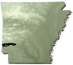
Stratigraphic Summary of the Mississippi Embayment and Gulf Coastal Plain
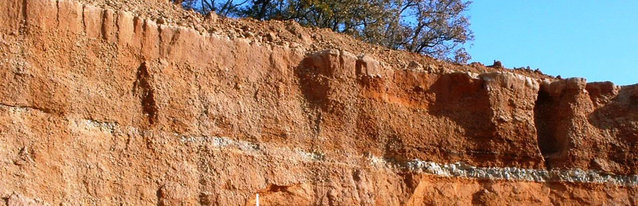
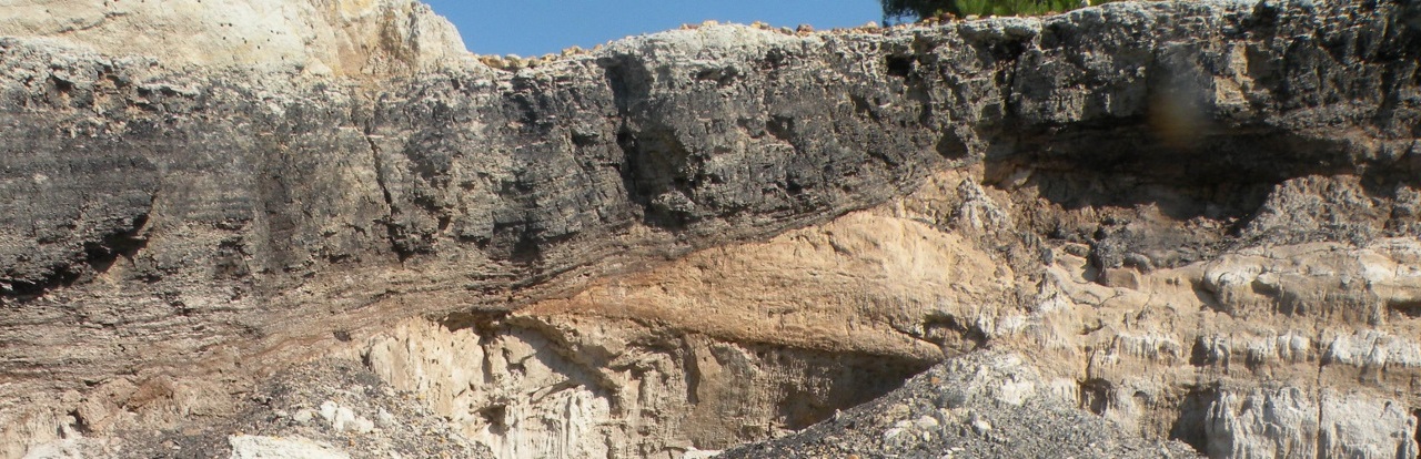
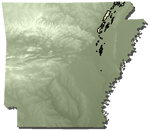
Eastern and southern Arkansas are underlain by Cretaceous age through recent sedimentary deposits with small areas of igneous intrusions of Cretaceous age. Cretaceous sedimentary deposits are exposed in southwestern Arkansas and represent shallow, marginal, and often restricted marine environments. Southern Arkansas is dominated by Tertiary marginal marine and coastal plain continental deposits with a veneer of Quaternary terrace and alluvial deposits. Eastern and northeastern Arkansas is dominated by Quaternary terrace and alluvial deposits with minor exposures of Tertiary units. At least three terrace levels are recognized in the region. The Mississippi Embayment manifests a north-south linear erosional remnant Crowley’s Ridge, which is generally capped by Quaternary loess and preserves minor exposures of Tertiary deposits along its margins. Topographically, the entire area ranges from low hills to essentially flat terrain.
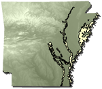
Stratigraphic correlation charts for West Gulf Coastal Plain and Mississippi River Alluvial Plain subregions of the Gulf Coastal Plain of Arkansas
Trinity Group/Formation
Age: Early Cretaceous Period, Comanchian Series
Distribution: Gulf Coastal Plain in southwest Arkansas. Parts of Little River, Sevier, Howard, Hempstead, Pike, Clark, and Nevada counties; Texas, Louisiana, Oklahoma
Geology: The Trinity Group is comprised of sand, gravel, clay, limestone, and evaporite deposits. Gypsum is mined commercially from this unit. Prominent members of the Trinity Group include the Pike Gravel Member, the Dierks Limestone Member, and the DeQueen Limestone Member. The Pike Gravel, the basal member of the Trinity Group, is a bedded, 0- to 100-foot thick, pale-yellow to medium-orange, predominantly gravel-bearing deposit. The Dierks Limestone Member is a 0- to 70-foot thick, interbedded, greenish, calcareous clay and gray, fossiliferous limestone present in the lower part of the Trinity. The DeQueen Limestone Member, which varies from 0 to 100 feet in thickness, is present in the middle part of the Trinity Group sequence and is composed of interbedded green and gray calcareous clay, limestone, gypsum and celestite. The limestones are thin-bedded and sandy, but crystalline and fossiliferous intervals are present. The DeQueen Limestone Member is also noted for a dinosaur track-way site discovered in a mine near Nashville in Howard County. The upper part of the Trinity Group is mostly fine-grained, cross-bedded sand, usually weathered reddish. Marginal marine fossils are noted from the Trinity Group and carbonized logs are found between the Dierks and DeQueen Limestone Members. The base of the Trinity Group rests unconformably on a surface of upturned and eroded Paleozoic rocks. The Trinity Group ranges up to 1,000 feet in thickness, although it is usually much thinner.
Original Reference: R. T. Hill, 1888, Science, v. 11, p. 21
Type locality: Named for exposures on the Trinity River of Texas
Goodland Limestone/Formation
Age:Early Cretaceous Period, Comanchian Series
Distribution: Limited exposure along Little River north of Cerrogordo, Little River County, Arkansas, Gulf Coastal Plain; Oklahoma and Texas
Geology: The Goodland Limestone is a medium- to thick-bedded, hard, sandy, light-gray limestone with minor thin-bedded calcareous sandstone. Poorly preserved fossils are common. The lower contact is not exposed in Arkansas. The maximum exposed thickness of the Goodland Limestone is 35 feet; however, the entire unit may reach 50 feet.
Original reference: R. T. Hill, 1891, Geological Society American Bulletin, v. 2, p. 504- 514.
Type locality: Named for Goodland, Choctaw County, Oklahoma. (Old Goodland is present site of Good Switch on railroad, 3 miles south of Hugo, Oklahoma)
Kiamichi Formation
Age: Early Cretaceous Period, Comanchian Series
Distribution: Very limited exposure in Little River County, Arkansas Gulf Coastal Plain; Oklahoma, Texas
Geology: The Kiamichi Formation is composed of closely packed oyster shells in a matrix of dense, hard, gray-green marl interbedded with softer gray and green marls. Discontinuous beds and lenses of fossiliferous limestone are found in some outcrops. Almost all fossils associated with this unit are assigned to Gryphaea navia. The conformability of the lower contact has not been reported in Arkansas. A maximum of 20 feet of the Kiamichi Formation is reported.
Original reference: R. T. Hill, 1891, Geological Society of America Bulletin, v. 2, p. 504-515.
Type locality: Named for historic plains of Kiamichi River near Fort Towson, Choctaw County, Oklahoma
Woodbine Formation
Age: Late Cretaceous Period, Gulfian Series
Distribution: Gulf Coastal Plain in southwest Arkansas, parts of Pike, Howard, and Sevier Counties; Texas, Oklahoma, Louisiana
Geology: The Woodbine Formation is composed of bedded gravel, sand, bedded clay, and water-laid volcanic tuff and ash. The basal part of this unit is composed of gravel-bearing beds of variable thickness, which may be cemented by iron oxides to form a conglomerate. The overlying water-laid volcanic tuffs are sandy and cross-bedded. These sediments are blue-green when fresh, weathering to deep-red waxy clay-bearing units. Rare leaf fossils are noted from some clays of the Woodbine Formation. The formation was deposited upon an unconformable surface separating the Early and Late Cretaceous. The Woodbine Formation varies from 0 to 350 feet in thickness.
Original reference: R. T. Hill, 1901, U. S. Geological Survey 21st Annual Report, pt. 7, p. 293.
Type locality: Named for exposures at Woodbine, Cooke County, Texas
Tokio Formation
Age: Late Cretaceous, Gulfian Series
Distribution: Gulf Coastal Plain in southwest Arkansas in parts of Clark, Pike, Hempstead, Howard, Sevier and Little River Counties; Oklahoma
Geology: The Tokio Formation is composed of a basal gravel overlain by coarse sand that is interbedded with light- to dark-colored clays. Some beds of calcareous or ferruginous sandstone are present. The basal unit of bedded gravel is variable in thickness, ranging from 1 to 25 feet. This gravel may be cemented by iron oxides in places to form a conglomerate. The sands are brown to gray and generally cross-bedded. The dark-gray clay is pyritic and contains plant imprints. Kaolin beds are found in the Tokio Formation in Pike County. Fossils from the Tokio Formation include bivalves, gastropods, plant material, and a few vertebrate remains. The lower contact of the formaton is unconformable, resting on the Woodbine Formation in Little River County and successively older units eastward. In Howard County, the thickness of the formation is 300 feet and the formation thins to the east.
Original reference: H. D. Miser and A. H. Purdue, 1918, U. S. Geological Survey Bulletin 690, p. 19-24.
Type locality: Named for exposure in the vicinity of Tokio, Hempstead County, Arkansas
Brownstown Marl/Formation
Age: Late Cretaceous Period, Gulfian Series
Distribution: Gulf Coastal Plain in southwest Arkansas in parts of Clark, Pike, Hempstead, Howard, Sevier and Little River Counties; Texas, Oklahoma, (Louisiana?)
Geology: The Brownstown Marl is composed of clay marls, thin (sometimes sandy) limestones, sandy marls, and some fine-grained sands. Glauconite and some phosphatic material may be associated with the various lithologies. Color is quite variable, depending on the degree of weathering, iron content, and other factors, yielding tan, brown, blue, green, red, yellow, gray, or any color combination and hue. Near the base of the unit, beds of thin hard limestone exist that contain poorly preserved fossils. The marls in the formation are often highly fossiliferous. The most common fossils are oysters and other bivalves, some cephalopods, and occasional echinoderms, fish material, and annelids. The Brownstown Marl rests unconformably on underlying formations. The formation is about 250 feet thick in Howard County, but thins both to the east and west.
Original reference: R. T. Hill, 1888, Arkansas Geological Survey Annual Report 1888, v. 2, p. 72, 86-87, 188; 1894, Geological Society of America Bulletin, v. 5, p. 302.
Type locality: Named after Brownstown, Sevier County, Arkansas
Ozan Formation
Age: Late Cretaceous Period, Gulfian Series
Distribution: Gulf Coastal Plain, parts of Clark, Pike, Hempstead, Howard, Sevier and Little River Counties; Oklahoma
Geology: The Ozan Formation consists of tan, sandy, micaceous marl with a basal lentil of sandy marl and marly sand. The basal lentil, known as the Buckrange Sand, is highly glauconitic and contains shark teeth and phosphatic nodules. Another glauconitic interval is sometimes present about 55 feet above the base of the Ozan. Near the top of the formation, the marls become more chalky. An occasional bed of hard limestone occurs in some outcrops near the top of the unit. Some of the Ozan Formation marls are highly fossiliferous, commonly containing bivalves (mostly oysters), cephalopods, gastropods, echinoderms, corals, crustaceans, fish material, and annelids. The Ozan Formation lies unconformably upon the Brownstown Marl. The Ozan Formation ranges from 150 to 250 feet in thickness.
Original reference: C. H. Dane, 1926, U. S. Geological Survey Press Bulletin 8823, September 10, 1926.
Type locality: Named for exposures along the middle fork of Ozan Creek and for the town of Ozan, Hempstead County, Arkansas
Annona Chalk/Formation
Age: Late Cretaceous Period, Gulfian Series
Distribution: Gulf Coastal Plain in southwest Arkansas in parts of Hempstead, Howard, and Little River Counties; Texas, Louisiana, Oklahoma
Geology: The Annona Chalk is a hard, thick-bedded to massive, slightly fossiliferous chalk. It weathers white, but is blue-gray when freshly exposed. The unit is commercially mined for cement. Fossils in the Annona Chalk include coelenterates, echinoderms, annelids, bivalves, gastropods, cephalopods, and some vertebrate traces. The Annona rests conformably upon the Ozan Formation. The formation varies from 0 to 100 feet in thickness.
Original reference: R. T. Hill, 1894, Geological Society of America Bulletin, v. 5, p. 308.
Type locality: Named for outcrops about 2 miles northwest of Annona, Red River County, Texas
Marlbrook Marl/Formation
Age: Late Cretaceous Period, Gulfian Series
Distribution: Gulf Coastal Plain in southwest Arkansas in parts of Clark, Hempstead, Howard, and Little River Counties; Texas, Louisiana
Geology: The Marlbrook Marl is a uniform, chalky marl that is blue-gray when freshly exposed, and white to light-brown when weathered. This unit is moderately fossiliferous in its upper part, in contrast to the lower part where fossils are few. Common fossils include Exogyra, Gryphaea, and Ostrea oyster species and reptile remains. The lower contact of the formation is thought to be conformable with the Annona Chalk. The Marlbrook Marl varies from 50 to 220 feet in thickness.
Original reference: R. T. Hill, 1888, Arkansas Geological Survey Annual Report 1888, v. 2, p. 72, 84-86, 188.
Type locality: Typically exposed about 1 mile north of Saratoga, on road to Mineral Springs, Howard County, Arkansas; also exposed along Marlbrook Creek in T10S, R24W, Hempstead County, Arkansas
Saratoga Chalk/Formation
Age: Late Cretaceous Period, Gulfian Series
Distribution: Gulf Coastal Plain in southwest Arkansas in parts of Clark, Hempstead, and Howard Counties; Louisiana, Texas
Geology: The Saratoga Chalk consists of fossiliferous, hard, sandy, somewhat glauconitic chalk with some beds of marly chalk and chalky sand. It weathers white, light gray and light brown, and is blue-gray when freshly exposed. The common fossils found in the unit include sponges, bryozoa, echinodermata, annelids, bivalves, gastropods, cephalopods, crustaceans, and fish teeth. The formation displays an unconformity at its base, which represents a distinct faunal and lithologic break. The Saratoga Chalk ranges from 20 to 70 feet in thickness.
Original reference: J. C. Branner, 1898, American Institute of Mining Engineers Transactions, v. 27, p. 52-59.
Type locality: Named for exposures north and east of Saratoga in Hempstead and Howard Counties, Arkansas
Nacatoch Sand/Formation
Age: Late Cretaceous Period, Gulfian Series
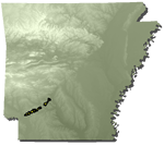
Distribution: Gulf Coastal Plain in southwest Arkansas in parts of Clark, Nevada, and Hempstead Counties; Louisiana, Texas
Geology: The Nacatoch Sand is composed of cross-bedded, yellowish and gray fine quartz sand; hard, fossiliferous sandy limestone; coarse, highly glauconitic sand; fine-grained, argillaceous blue-black sand; bedded light-gray clay and marl. The sands in the Nacatoch are generally unconsolidated. At the base of the unit hard, fossiliferous limestones and marl are present. Near the middle of the unit, a coarse, highly glauconitic lens exists. On outcrop, this lens appears almost black in places and may be up to 60 feet in thickness, but averages closer to 30 feet. Thin-bedded gray clay is present interbedded with fine sands close to the top of the unit. Fossils in the Nacatoch Sand include corals, echinoderms, bryozoa, annelids, bivalves, gastropods, cephalopods, crab remains, and some shark teeth. The Nacatoch Sand has an unconformity at its base. The formation varies in thickness from 150 to 400 feet.
Original reference: A. C. Veatch, 1905, Louisiana Geological Survey Bulletin 1, p. 84-88; and 1905, U. S. Geological Survey Water-Supply Paper 114, p. 180-183.
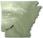
Type locality: Exposed at Nacatoch Bluff on the Little Missouri River, Clark County, Arkansas
Arkadelphia Marl/Formation
Age: Late Cretaceous Period, Gulfian Series
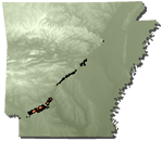
Distribution: Gulf Coastal Plain in southwest Arkansas in parts of Clark, Nevada, and Hempstead Counties; Louisiana, Texas
Geology: The Arkadelphia Marl is mostly a dark-gray to black marl or marly clay with some limy, gray sandstone, gray sandy clay, sandy limestone, concretionary limestone, and white to light-brown impure chalk. The sandy marls and limestones are at or near the base of the unit, while the impure chalks are present in the upper part of the formation. (The strata that Hill first applied the name "Arkadelphia" to are no longer considered a part of this unit.) The fossil fauna includes corals, bivalves, gastropods, cephalopods, shark teeth, and various microfossils. The Arkadelphia Marl rests unconformably on the Nacatoch Sand. The formation is 120 to 160 feet in thickness.
Original reference: R. T. Hill, 1888, Arkansas Geological Survey Annual Report 1888, v. 2, p. 53-56, 188.
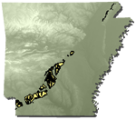
Type locality: Typical exposures of the Arkadelphia (in its modern sense) are present 5 to 7 miles north and northwest of Hope, between U. S. Interstate 30 and Prescott along Arkansas Highway 19, and in the Oakhaven area
Midway Group
Age: Tertiary Period, Paleocene Epoch
Distribution: Central to southwestern Arkansas, in a band of exposure from Cabot to Texarkana; Texas to Georgia, Illinois, Kentucky, Missouri, and Tennessee
Geology: The Midway Group sequence exposed in Arkansas represents a marginal marine depositional environment. The lithologies include calcareous shale, arenaceous limestone, calcareous glauconitic sandstone, conglomerate, and light to very dark bluish-gray clay shale. The Midway Group interval is not normally divided into formations in Arkansas; however, various workers have indicated that it is possible to divide the unit into two formations: the lower Clayton Formation and the upper Porters Creek Formation. The Clayton Formation contains most of the calcareous and sandy lithologies, whereas the Porters Creek Formation is chiefly composed of shales and silty shales. The fossils of the Midway Group include a rich fauna of bivalves, gastropods, foraminifera, and ostracods with bryozoa, brachiopods, echinoids, crabs, fish, and crocodile teeth fossils also present. The lower boundary of the Midway Group is unconformable. The thickness ranges from a feather-edge to 130 feet on the outcrop; in the subsurface, the unit is usually much thicker.
Original reference: G. D. Harris, 1894, American Journal of Science, 3d, v. 47, p. 303-304; and, 1896, American Paleontology Bulletin, v. 1, n. 4, p. 10-38.
Type locality: Named for exposures at Midway Landing and plantation on west side of the Alabama River (about 5 miles below Prairie Bluff) in Wilcox County, Alabama
Wilcox Group
Age: Tertiary Period, Eocene Epoch
Distribution: Central to southwestern Arkansas, in a wide band of exposure from Cabot to Texarkana, along the west side of Crowley’s Ridge north of Jonesboro; Texas to Georgia, Illinois, Kentucky, Missouri, and Tennessee
Geology: The Wilcox Group is a thick series of non-marine sands, silty sands, clays, and gravels with some thick deposits of lignite. In central Arkansas, bauxite is found at the base of the Wilcox near Cretaceous syenite knobs that were positive topographic features during Wilcox time. The sands are generally fine- to very fine-grained and light-gray when fresh. The clays are light-gray or brown and often sandy or silty. Frequently, either lithology will be dark brown to black when enough carbonaceous material is included. The lignites occur throughout the sequence, controlled by depositional environment rather than stratigraphic position. Some workers divide the Wilcox Group of Arkansas into three formations: the Berger, the Saline , and the Detonti Formations. Plant remains and trace fossils, associated with the lignites and lignitic clays, are the most common fossils present. The lower contact of the Wilcox is unconformable with the Midway Group and unconformities occur within the sequence. The thickness of the Wilcox Group ranges from a feather edge to as much as 1,025 feet with 850 feet often reported as average.
Original reference: A F. Crider and L. C. Johnson, 1906, U. S. Geological Survey Water-Supply Paper 159, p. 5, 9; A. F. Crider, 1906, U. S. Geological Survey Bulletin 283.
Type locality: Named for extensive exposures in Wilcox County, Alabama
Claiborne Group
Age: Tertiary Period, Eocene Epoch
Distribution: West Gulf Coastal Plain of southern Arkansas and Crowley’s Ridge in eastern Arkansas; Gulf Coastal Plain from Georgia to southern Texas
Geology: The Claiborne is chiefly non-marine in origin, but does contain some marine intervals. The unit is composed of medium- to very fine-grained sands, silts, and silty clays. The sands tend to be light- to dark-gray, white, brown, or red, depending on the degree of weathering. The silts and clays are light- to dark-gray and sometimes variegated. Intervals enriched in carbonaceous material are dark-brown to black. The silts are usually clayey and the clays are normally silty or sandy. Lignite beds are present in this interval. Lignite deposition was controlled by the geologic environment. In the subsurface, the Claiborne Group has been divided into the Carrizo Sand, Cane River Formation, Sparta Sand, Cook Mountain Formation, and Cockfield Formation. Fossils include fish and reptile bones and teeth, leaf impressions, lignitic wood, and trace fossils. The lower contact of the Claiborne Group is poorly known, but considered unconformable to the Wilcox Group. The thickness of the Claiborne ranges from a thin edge to 1,500 feet.
Original reference: T. A. Conrad, 1847, Philadelphia Academy of Natural Science Proceedings, v. 3, p. 280-282
Type locality: Named for exposures at Claiborne Bluff and Claiborne Landing on the Alabama River in Monroe County, Alabama
Jackson Group
Age: Tertiary Period, Eocene Epoch (upper)
Distribution: Southeast Arkansas and southern Crowley’s Ridge in eastern Arkansas; Gulf Coastal Plain from Georgia to southern Texas
Geology: The Jackson Group is divided into two distinct units in Arkansas: a lower marine unit called the White Bluff Formation and an overlying non-marine unit called the Redfield Formation. The blue-gray to off-white White Bluff Formation has three dominate facies: an argillaceous sand containing glauconite and rich in molluscan fossils, a calcareous glauconitic clay with common invertebrate fossils, and a blocky clay with some silt and a trace of sand and invertebrate (mostly molluscan) molds. The Redfield Formation is typically a sequence of light-gray, thinly laminated silts, silty clays, and silty sands. Crossbedded sands and minor lignite beds are present in the Redfield Formation with plant remains being locally abundant. A minor disconformity occurs at the base of the Jackson Group sequence. The thickness of the Jackson Group may be 300 feet, but no outcrop areas exhibit the entire Arkansas section.
Original reference: T. A. Conrad, 1856, Philadelphia Academy of Natural Science Proceedings, v. 7, p. 257-258; E. W. Hilgard, 1860, Rept. Geology and Agriculture Mississippi, p. 128-135.
Type locality: Named for exposures at Jackson, Mississippi, along the Pearl River and Moodys Branch
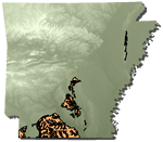
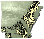
Sand And Gravel

Age: Quaternary Period, Pleistocene Epoch (Late Tertiary, Pliocene Epoch?)
Distribution: Crowley’s Ridge in eastern Arkansas
Geology: Sands and gravels are present on Crowley’s Ridge underlying loess deposits. This interval has not been assigned to a specific stratigraphic unit or studied in detail.
Loess
Age: Quaternary Period, Pleistocene Epoch
Distribution: Crowley’s Ridge in eastern Arkansas
Geology: Although loess undoubtedly occurs in other places, only on the middle and southern portions of Crowley’s Ridge is it specifically mapped. It consists of tan, brown, reddish-brown calcareous silt in thin to massive beds. Many workers recognize three separate loess units: an upper thick loess, a middle thin loess, and a lower thick loess. Loess will often hold a high vertical slope. Calcareous concretions are regularly found in the unit. Fossils of pulmonate gastropods are fairly common with fresh water mollusks and proboscidean bones less common. The lower contact of the loess is unconformable with underlying units. The thickness increases from north to south ranging to 140 feet, although 40 to 60 feet is more common at the southern end of Crowley’s Ridge.
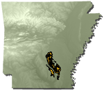
Silt And Sand
Age: Quaternary Period, Pleistocene Epoch
Distribution: Crowley’s Ridge in eastern Arkansas
Geology: The northern portion of Crowley’s Ridge is capped by an interval of unconsolidated silt and sand with lenses of clay and gravel. This unit has never been studied in Arkansas.
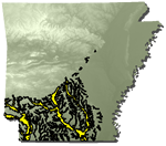
Dune Sand
Age: Quaternary Period, Pleistocene Epoch
Distribution: Mississippi River Embayment in eastern Arkansas
Geology: The sand dunes generally consist of homogeneous, massive, well-sorted, tan or buff to grayish- or reddish-brown, fine sands. Cross-stratification and bedding features are lacking in the interval, apparently due to extensive weathering and biogenic reworking. These sands are thought to be derived from glacial outwash originally deposited along major drainages during the initial stages of interglacial times. The dunes are best developed on the east sides of the White, Current, and Black Rivers. The dune sand fines with distance from these rivers. Dunes are present on all terrace levels, but not on present-day alluvium. No significant fossils have been discovered associated with these sands. The lower contact seems to be unconformable in most places.
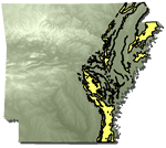
Terrace Deposits
Age: Quaternary Period, Pleistocene Epoch
Distribution: Eastern and southern Arkansas, Mississippi River Embayment, West Gulf Coastal Plain
Geology: The terrace deposits include a complex sequence of unconsolidated gravels, sandy gravels, sands, silty sands, silts, clayey silts, and clays. The individual deposits are often lenticular and discontinuous. At least three terrace levels are recognized with the lowest being the youngest. Fossils are rare. The lower contact is unconformable and the thickness is variable.
Alluvium
Age: Quaternary Period, Holocene Epoch
Distribution: State wide
Geology: The deposits consist of alluvial sediments of present streams and include gravels, sands, silts, clays, and mixtures of any and all of these. The partition of this unit from other Holocene alluvial deposits was based more on geomorphic considerations than on lithology or age. Fossils are rare and modern. The lower contact is unconformable and the thickness is variable.
Alluvium (Stream Overbank)
Age: Quaternary Period, Holocene Epoch
Distribution: Eastern Arkansas, Mississippi River Embayment
Geology: The deposits indicated by this notation are alluvial deposits of small streams, the overbank deposits of major streams, or older meander belt deposits of major streams. The partition of this unit from other Holocene alluvial deposits was based more on geomorphic considerations than lithology or age. Fossils are rare. The lower contact is unconformable and the thickness is variable.
Alluvium (Channel Meander)
Age: Quaternary Period, Holocene Epoch
Distribution: Eastern Arkansas, Mississippi River Embayment
Geology: This unit represents the more recent channel meanders and current flood plain deposits of significant streams. Channel meander scars are distinct in this unit. The partition of this unit from other Holocene alluvial deposits was based more on geomorphic considerations than lithology or age. Fossils are rare. The lower contact is unconformable and the thickness is variable.