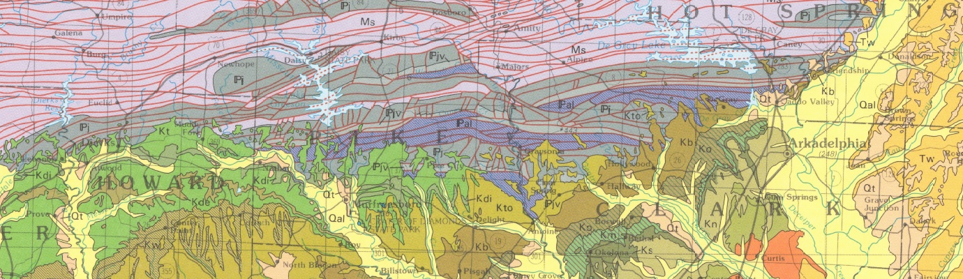
Geologic Map of the Arkadelphia 30'x60' Quadrangle, Clark, Garland, Hempstead, Hot Spring, Howard, Montgomery, Pike, and Polk Counties, Arkansas
| AGC/AGS Series | Digital Geologic Maps |
| Number Series | DGM-AR-01100 |
| Title | Geologic Map of the Arkadelphia 30'x60' Quadrangle, Clark, Garland, Hempstead, Hot Spring, Howard, Montgomery, Pike, and Polk Counties, Arkansas |
| Author (s) | Geology by Boyd R. Haley, Charles G. Stone, Benjamin F. Clardy, and William D. Hanson |
| Date | 2009 |
| Scale | 1:100,000 |
| General Description |
The Geologic Map of the Arkadelphia 30'x60' Quadrangle is a compilation of the Amity, Antoine, Arkadelphia, Athens, Big Fork, Bismarck, Bonnerdale, Caddo Gap, Caddo Valley, Center Point, Center Point NE, Chalybeate Mountain East, Chalybeate Mountain West, De Gray, De Roche, Delight, Glenwood, Hempwallace, Hollywood, Hot Springs South, Langley, Lodi, Murfreesboro, Murfreesboro NE, Narrows Dam, Nathan, Newhope, Norman, Okolona North, Pearcy, Point Cedar, and Polk Creek Mountain 1:24,000 scale geologic worksheets. The geology of the Cretaceous area was mapped by W.D. Hanson and B.F. Clardy in 1994, and the geology of the Paleozoic area was mapped by B.R. Haley and C.G. Stone, 1994.
|
| Availability | Yes. Paper copy or free download. |
| Price | Paper copy is $30.00 or download map for free. |
| Shipping and handling | Contact Sales Office at (501) 296-1877, for shipping and handling charges. |
| Online Version |
Download PDF |